Submitted by: BuckyHermit (from Vancouver, BC, Canada)
Country: United States

Country: Canada

State: Washington, United States
Province: British Columbia, Canada
City: Point Roberts, Washington
City: Delta, British Columbia
Location: Boundary Marker No. 1 [US map] [Canada map]
Status since photo:

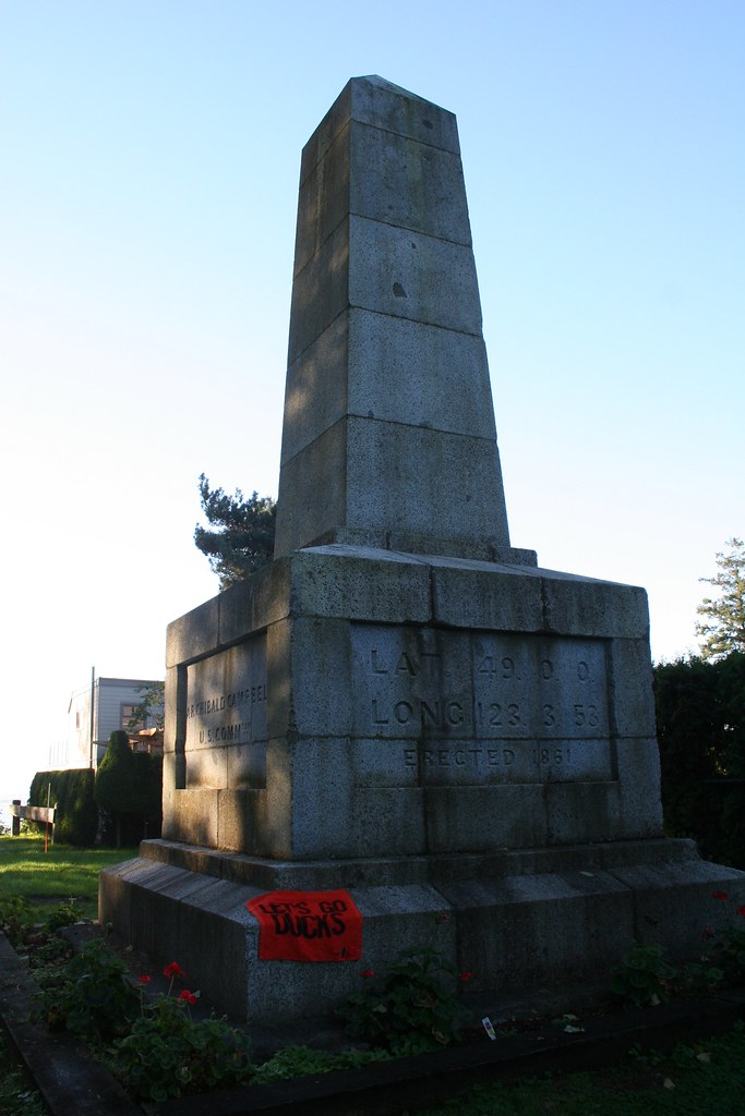
Boundary Marker No. 1 is a historic border marker between the United States and Canada; it is the western-most land border marker between the two countries. It lies on the 49th parallel, the border agreed upon by the United States and Great Britain on June 15, 1846, and the monument was placed here in 1861. From this point westwards, all contiguous American territories are south of the 49th parallel and share no land border with Canada. Unlike other boundary markers, Boundary Marker No. 1 lies mainly on American soil.